

By Ikechukwu Onuoma Esq. and Surv. Ekene Okoroafor J.

Technological advancement in the field of aerodynamics has triggered the invention of drones. Drone mapping is the use of drones to carry out precise 3-dimensional mapping of areas (especially areas in dispute or areas that are inaccessible) that could be used in preparing a dispute survey plan. A dispute survey plan is a pictorial representation of the land in dispute with reference to features and boundaries of the land based on a chosen scale and specific measurements. Images and other information acquired by the drone are analyzed and presented as a dispute survey plan using a Geographic Information System (GIS) software.
When preparing a dispute or litigation survey plan, the surveyor knows it is essential to show features that will fortify the evidence. These features could be old existing features or real time captured features. In most cases superimposing or charting of one feature over another by the surveyor is highly recommended. This is done in order to establish a proper relationship in his evidence as presented in a litigation survey plan. This could be achieved to a very sound accuracy by employing drones to capture the aerial view of the land in dispute. Thereafter, a critical analysis and representation of the information acquired are accomplished using a GIS platform.
In most land dispute cases for the safety of the surveyor, it might not be best interest to physically carry out surveys and measurements on ground. Especially if the surveyor is not accompanied by security operatives but he could adhere to remotely acquire information about the land through drone mapping. Drone mapping is built on the integration of Global Positioning System (GPS) and 3D aerial drone capture to produce a digital boundary map (includes also digital elevation model, tree canopy height model, contours etc.) referenced to a geographic coordinate and drawn to scale, employing a sound cartographic skill. This is usually done by surveyors trained on drone piloting and GIS analysis. The use of drones for mapping removes the risk of physical assault on the surveyor and his team members while they are conducting their surveys on ground.
During the course of land dispute cases, dispute survey plans are admissible in court as evidence with respect to the identity and features of a land. A piece of land is usually identified by natural features, conventional features, boundary beacons etc. These natural features include rivers, mountains, hills, grasslands, ditches, trees, center of roads and other physical features like a market grave yard maybe conventional. Quite a few parcels of land under contention have their property survey plans prepared earlier. 3D digital map acquired in real-time by a drone plays a vital role in representing all these features, subsequently the features are plotted by a surveyor and drafted into a survey plan. However, as Surveyor Edward Ejiofor Ezeanaka rightly puts it: “At times, there may be features of evidential importance whose minuet size may not be captured or identified by a drone. Then ideally a proper ground truthing must be done to represent these key features in the survey plan”. When there are features that cannot not be capture by the drone, the surveyor is required to make an extra effort to capture these small details and represent them accordingly in the dispute survey plan.
In most dispute survey plans, the third dimensional attributes and contours are rarely represented. They could be an immeasurable attribute if rightly presented in the litigation survey plans. Survey beacons serve as a boundary indicator and has a penal effect if tampered with. To this effect if the third dimensional attribute (orthometric height value or contour value) is attached to these beacons in the litigation survey plan, it could serve as a plus to validate the position of the survey beacons whenever it has been fiddled with. Following the reasoning that boundary beacons could be moved off from its original position but the actual topography of land is always maintained. It will be to a greater advantage if topographic survey plans are incorporated as one of the registrable land instrument for acquisition of certificate of occupancy and certificate of ownership. What else could form a better representation of the landed property than an actual replica of its topography on paper?
Ikechukwu Onuoma Esq.Managing Partner Obra Legal And Surv. Ekene Okoroafor J. Licensed Surveyor and GIS consultant
[A MUST HAVE] Evidence Act Demystified With Recent And Contemporary Cases And Materials
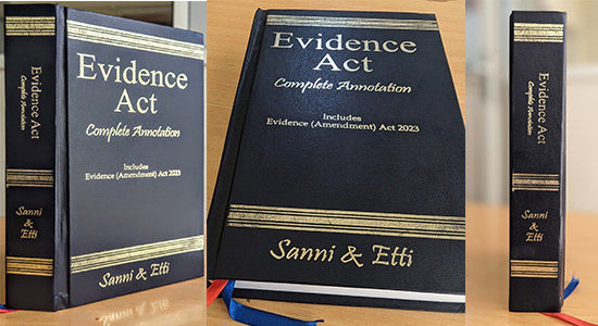
Available now for NGN 40,000 at ASC Publications, 10, Boyle Street, Onikan, Lagos. Beside High Court, TBS. Email publications@ayindesanni.com or WhatsApp +2347056667384. Purchase Link: https://paystack.com/buy/evidence-act-complete-annotation
______________________________________________________________________ “Enhance Legal Practice With Authoritative Reports” — Alexander Payne Offers Comprehensive Law Reports, Spanning Over A Century Of Nigerian Jurisprudence Interested buyers are encouraged to place their orders and enquiries via:
0704 444 4777, 0704 444 4999, 0818 199 9888
Website: www.alexandernigeria.com
Interested buyers are encouraged to place their orders and enquiries via:
0704 444 4777, 0704 444 4999, 0818 199 9888
Website: www.alexandernigeria.com